
|
|
|
|
|
|
|
|
|
|
|
|
When Hasenclever first settled the Ringwood area to build an iron industry, one of his greatest challenges was to build roads over rocky, forbidding terrain. Some of these roads have formed the basis for our highways today, but others are forgotten, dimly seen paths in the woods.
When Robert Erskine took over Hasenclever's position, he also took over responsibility for keeping the roads to the other ironworks clear. But Erskine did more than that - he made maps of the roads. From one of his 18th Century maps, we can see that there was a major route between Ringwood and Long Pond. This road winds through the mountains and past other sections rich in ore. By the 20th Century the road disappeared from the maps, but you can still see a thin trail in aerial photographs. One of the projects of Ringwood Manor and Long Pond Ironworks is to mark this road in its entirety for use as a historic trail.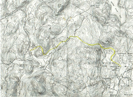
The project is still in its early stages. Much of the 200+ year old road is unmistakable - it was used so heavily by horses carting iron that it has been worn three or more feet into the ground. But other sections have been lost, and we are still trying to find the most probable route.
You can click on the map above to see a larger version, suitable for printing. However, don't try this road on your own. You'll get lost. If you want to be part of the team that is making this historic road accessible to everyone, email us at .